Modern achievements of Karelia briefly. Our achievements. Karelia is located in the taiga - a zone of coniferous forests
Symbols of Karelia Our native land is Karelia! An ancient wise land. Brotherly tribes are one family, Karelia! Our native land is Karelia! An ancient wise land. Brotherly tribes are one family, Karelia! Ring, lakes, and sing, taiga! Native land, you are dear to me. I stand high on your hills and sing a song in your glory. Ring, lakes, and sing, taiga! Native land, you are dear to me. I stand high on your hills and sing a song in your glory. Anthem Coat of Arms Flag

The climate of Karelia depends on its geographical location. The sun does not rise high here, so it brings little heat. A lot of water evaporates from the surface of reservoirs, which leads to the formation of clouds. The forest softens the climate: summers are cooler and winters are warmer. Therefore: There may be thaws in winter There may be thaws in winter There are infrequently hot days in summer Infrequently hot days in summer Severe frosts are rare Severe frosts are rare Most of the year is cloudy Most of the year is cloudy It often rains or snows It often rains or snows


On the territory of Karelia there are the two largest lakes in Europe: Ladoga and Onega. Two great lakes of Russia. Deep, cold and clear. Two great lakes of Russia - Two loves, two songs, two dreams... ...Ladoga and foamy Onego. Light, high wave, Purity of my lakes - from the snow, from the great earth - depth. V. Potievsky


Rivers of Karelia The longest river in Karelia is the Vodla. Its length is 400 km. The longest river in Karelia is the Vodla. Its length is 400 km. On the Suna River there is the largest waterfall in Karelia, Kivach. The total height of the fall is 10.7 m. On the Suna River there is the largest waterfall in Karelia, Kivach. The total height of the fall is 10.7 m. The diamond mountain is pouring down from the heights with four rocks, the abyss and silver are boiling below, hitting upward with mounds; The blue hill stands from the spray, Far away the roar in the forest thunders... G.R. Derzhavin

Prehistoric period
The territory of Karelia began to be populated after the disappearance of ice sheets in the post-glacial period - in the 7-6 millennium BC. e. The main occupations of the ancient inhabitants were hunting and fishing. In the 1st millennium BC. e. Iron production was mastered, and the beginnings of agriculture and animal husbandry appeared.
The ethnic composition of the population has been known since the end of the 1st millennium AD. e. By this time, tribes of the Finno-Ugric group lived on the territory of the region: on the Karelian Isthmus and in the Northern Ladoga region - the Karelians, between Lakes Ladoga and Onega - the Vepsians, and further to the north - the Sami (Lop). At the beginning of the 2nd millennium AD. e. part of the Karelians advanced to the shores of the Gulf of Bothnia and the White Sea. At the same time, the Slavic population penetrated into the northern and eastern Obonezhye and on the coast of the White Sea, contributing to the development of agriculture, salt making and maritime industries.
There is a hypothesis that the earliest mention of the Karelians is found in Jordan’s book “On the Origin and Deeds of the Goths”, dated to the 6th century, where the list of peoples conquered by Germanaric includes “Thiudos in Aunxis” (according to F. Brown, “Olonets Chud”).
Karelia in the Viking Age
- 7th century - mention of Karelia as an independent state and of the Karelians as subjects of Ivar Wide Embraces in the “Acts of the Danes” by Saxo Grammar and in the “Saga of the Ynglings”.
- In the “Saga of the Ynglings,” the king given by Ivar Wide Arms died in a certain area called Kiryalabotnar or “Karelian Gulf” (perhaps referring to the Baltic Sea coast or the Gulf of Finland).
- 10th century - In the “Saga of Halfdan, son of Eystein,” Karelia (under the name Kirjalanbotnar) is mentioned as a single state under the control of a certain Grim.
- 1015 - The Saga of Saint Olaf mentions the visit of the Norwegian king to Karelia and the Karelian Valet.
- 1065-1085 - the first Novgorod written source mentioning Korel - Novgorod birch bark document No. 590, which talks about the Lithuanian attack on Karelia
There is a hypothesis that during the Viking Age, the Karelian Isthmus in the north and south was cut by two channels from Lake Ladoga to the Baltic Sea and it corresponded to the Rus Island of Arab sources.
Karelian land
Karelian land is an ethno-territorial and economic-cultural entity that formed along the Vuoksa.
Karelian land is an autonomy within the Obonezh and Votskaya Pyatina of the Novgorod Republic, which existed from the 11th century to 1338.
In the middle of the 13th century, Obonezh, Votsk and Izhora lands were firmly part of the Novgorod state.
In 1277-1278, almost immediately after the reign, the Novgorod prince Dmitry Alexandrovich, who initially had to make a lot of efforts to strengthen his position in Novgorod, went with an army to the Korel land and “executed the Korels, and took their land for a shield.” There could be several reasons for the punitive expedition: the independence of the Korelian tribal nobility in collecting tribute, in trade affairs, and in contacts with Western neighbors and participation in the anti-princely struggle in Novgorod in the ranks of Dmitry’s opponents.
The military campaign entailed some administrative measures. The tribal territory of the Korela, which consisted of 10 graveyards, began to be called the Korela land, the center of which became the town of Korela at the beginning of the 14th century. For the first time, the term “Korelian land” appears in Russian chronicles in the years 1278 and 1293. Management was carried out by the Russian administration (possibly with some participation from the Koreli). A service prince and a governor were placed at the head of the Korel land.
Boris Konstantinovich from the Tver princely family became the first prince. But he turned out to be a short-sighted politician and ruler. As a result of the prince's oppression, part of the Korela rebelled and took the side of the Swedes. The sentence of the Novgorodians sounded harsh: let him leave the Novgorod volost, and no longer feed him with Novgorod bread.
Anti-feudal protests in Korelia were complicated by Swedish aggression. The next uprising occurred in 1314-1315. In Korel, Russian townspeople were killed, and then the Swedes were allowed into the city. But as soon as the Novgorodians, under the leadership of the governor Fedor, approached the city, the Karelians went over to the side of the Novgorodians. The Swedes and Karelians “perevetniki” (traitors) were executed.
The uprising in Korel is not a random occurrence. It was preceded by peasant movements in Finland. The wave of uprisings forced the official circles of Sweden and Novgorod to hurry up with peace negotiations in 1323. In 1323, at the source of the Neva from Lake Ladoga, the Novgorodians built the Orekhov fortress. In the same year, a peace treaty was concluded in the newly built fortress, according to which the Novgorodians ceded three parishes in western Karelia to the Swedes. The agreement essentially recorded the seizure carried out by the construction of Vyborg.
In 1337-1338 there was a new uprising. There are two versions about him. According to the Novgorod chronicle, the rebels, with the help of the Swedes, killed many Novgorod and Ladoga merchants and other Christians living in the King, then fled to Vyborg, where Christians also suffered at their hands. The Sofia Chronicle presents events somewhat differently. The Swedes approached the King, and the governor Valit Korelyanin surrendered the city to the Swedes. The Novgorodians only approached the fortress at the beginning of July, and Valit went over to the side of the strong, in this case, the Novgorodians. The Swedes were punished.
Finding themselves between two fires (Novgorod and Sweden), the Karelians tried to play on the contradictions of the warring parties in order to achieve the most advantageous position (for example, the subordination of foreign merchants in Karelia to local jurisdiction, and not to Novgorod). Occasionally, Karelians even made attempts to achieve political independence.
Since 1338, Orekhov, together with the cities of the Karelian and Votskaya lands, was given to the Lithuanian prince Narimont for feeding. The Novgorodians did the latter in order to improve the defense of the western and northwestern borders. The lands given to Prince Narimont formed a kind of “Karelian Principality”.
In the winter of 1338/39, the Novgorodians sent ambassadors to the Swedes in Vyborg to negotiate peace, which, however, were not successful. In 1339, the ambassadors found the Swedish king in the Murmansk land, “in the city of Lyudovli” (probably Ledos) and made peace according to old charters.
Korelian half
Late 1530s - early 1550s. The government carried out a local government reform called “lip reform”. Lips - police - investigative districts. In the Novgorod land, the reform was carried out on the basis of the military five system. Oreshkovsky, Ladoga and Korelsky districts formed a single provincial district - the Korelsky half of the Vodskaya Pyatina of the Novgorod land. Zaonezhsky churchyards entered the Zaonezhsky half of the Obonezhskaya Pyatina.
Karelian Duchy
The Karelian Duchy is a duchy, divided into fiefs and counties, within Sweden.
Russian Empire
After the creation of the Ingermanlad province in 1708, the territory of Karelia became part of it. Since 1710 - as part of the St. Petersburg province.
In 1721, according to the Treaty of Nystad, which ended the Northern War, all of Karelia was annexed to Russia. When a separate Novgorod province was allocated in 1727, Olonets district became part of its Novgorod province.
In 1743, after the Russian-Swedish war of 1741-1743 under the Peace of Abo, the Russian-Swedish border moved west - Kymenigord fief with the Neyshlot fortress was annexed to Russia. A personal decree of August 24 (September 4), 1776 established the Novgorod viceroyalty, within which the Olonetsk region was created, which included five counties: Olonetsky, Petrozavodsk (former Petrozavodsk department), Vytegorsky, Padansky district (former Lopsky Padan commissariat) and Kargopolsky district . In 1780, from the Turchassky camp of the Kargopol district, the Onega district was created, which became part of the Vologda governorship.
On December 11 (22), 1781, the Olonets region was transferred from the Novgorod governorship to the St. Petersburg province. On May 12 (23), 1782, the administrative center of the region was approved by the city of Petrozavodsk (instead of Olonets). The center of Padansky district was moved from Padana to Povenets, and Padansky district was renamed Povenetsky.
By a personal decree of May 22 (June 2), 1784, the Olonets region was separated from the St. Petersburg province and transformed into an independent Olonets governorship.
By a personal decree of May 16 (27), 1785, Lodeynopolsky, Kemsky and Pudozhsky districts were additionally formed as part of the governorship. At the same time, part of the territory of the Onega district of the Arkhangelsk governorship was transferred to the Olonets governorship, as a result of which the Olonets governorship received access to the White Sea.
19th century
By a personal decree of September 9 (21), 1801, the Olonets province was formed. The Senate decree of October 10 (22), 1802 determined the administrative center of the province - the city of Petrozavodsk.
In 1809, after the Russian-Swedish “Finnish” War, all of Finland became part of the Russian Empire, receiving the status of the Grand Duchy of Finland. In 1812, as a gesture of goodwill, Alexander I annexed “Old Finland” to the principality.
According to data from 1875, Karelians lived in the southern part of Finland and the northwestern provinces of Russia: in the Olonets province - everywhere, in solid masses in the counties: Povenets, Petrozavodsk, Olonetsky, Lodeynopol and Vytegorsk, in the Tver province - everywhere, in the Novgorod province - everywhere , in the Arkhangelsk province in the Kem district, in the St. Petersburg province - in the districts of St. Petersburg and Shlisselburg. In addition, there were Karelian settlements in the Kaluga province (Medynsky district), Yaroslavl province (Mologsky district), Vladimir province (Suzdal district), Tambov province (Morshansky district), Vologda province (Vologda district) and Smolensk province (Gzhatsky district).
XX century
According to the 1902 census, 67% of all land in Karelia belonged to the treasury, monasteries, churches and landowners, most of the remaining 33% of the land belonged to the kulaks; There were only 14.5% of Karelians who were literate, and even fewer among women.
In 1914, Russia entered the First World War. Since the Black and Baltic Seas were blocked by the enemy, it was decided in Russia to build a railway from Petrozavodsk to Murman and at the same time a port on the ice-free Kola Bay in order to be able to uninterruptedly deliver military cargo from the Entente allies.
Revolutionary years (1917–20)
February Revolution (1917)
On February 27 (March 12) an armed uprising began in Petrograd. On March 2 (15), Tsar Nicholas II, while in Pskov, abdicated the throne for himself and his son Alexei.
Only at the beginning of March did the authorities of the Olonets province decide to tell the population about the revolutionary events in the country. On the evening of March 3, during a concert in the building of the Public Assembly of Petrozavodsk, a group of Baltic sailors announced a manifesto on the abdication of the Tsar. The next morning, sailors and soldiers began to disarm the police and gendarmerie. Workers of the Aleksandrovsky plant, soldiers of the railway battalion and students staged a rally and demonstration. A notice was sent to the districts of the province about the fall of the autocracy and the formation of the Provisional Government.
On March 3, a temporary committee of public safety (CPS) was assembled in Petrozavodsk from representatives of the city duma, clergy, intelligentsia, soldiers and workers of the city. The presidium of the KOB was headed by the Social Democratic-Internationalist railway engineer L.V. Nikolsky. The KOB was the only authority in the city; it included several commissions. They obtained from the factory administration an increase in wages, the introduction of an 8-hour working day, and began recording food and basic necessities (a standard for the release of food from the city's trading establishments was established). A militia was created from volunteers, workers and high school students.
At the beginning of March, in the county town of Kem, Arkhangelsk province, a COB was formed from representatives of the old administration and workers; in the city of Lodeynoye Pole, Olonets province, an executive committee for the protection of public order was formed from zemstvo officials and representatives of the local bourgeoisie; COBs were created in Pudozh, Povenets, and Kholmogory. The chairmen of the district zemstvo councils became district government commissioners.
Civil War (1918–20)
In 1919, the White Guard troops of the Northern Army were opposed by the 6th Army (Red Army), and the Onega Military Flotilla acted on the Onega and Ladoga lakes from the Bolsheviks.
Karelian labor commune (1920–23)
On June 8, 1920, the Karelian Labor Commune was created - a national autonomy within the RSFSR. It was created along the border with Finland on the territory of part of the Olonets and Arkhangelsk provinces. At the same time, Petrozavodsk became a “double” capital - the main provincial city and the center of Karelian autonomy. The government of the labor commune was headed by the “red” Finn Edward Gylling.
In the fall of 1921, the Karelian uprising began. The Karelians, who were opposed to the Bolsheviks and Soviet power, received support from Finland. By the end of December 1921, rebel forces, supported by Finnish volunteers, controlled a significant part of North-East Karelia, and only then did the Soviet leadership decide to form the Karelian Front led by A. I. Sedyakin, where a number of Red Army units numbering up to 20 thousand were transferred . Human. By mid-February 1922, when the last stronghold of the rebels, the village of Ukhta, was occupied by the Reds, the resistance of the Karelian-Finns was finally broken. About 30 thousand Karelian refugees went to Finland.
Autonomous Karelian SSR (1923–36)
On July 25, 1923, the All-Russian Central Executive Committee and the Council of People's Commissars of the RSFSR adopted a decree on the transformation of the Karelian Labor Commune (KTK) into the Autonomous Karelian Soviet Socialist Republic (AKSSR). The administrative apparatus was formed from Karelians and Finns. Finns who arrived after the defeat of the workers' revolution in Finland took leadership positions in government, economics and culture.
Finnish emigrants from all over the world, including the USA and Canada, began to be invited to Karelia for permanent residence - they came to the CPC to build Soviet Finland as an alternative to neighboring bourgeois Finland.
In 1925, on empty lands next to Olonets, a group of Finnish emigrant workers from Canada founded one of the first agricultural production associations in Karelia, the commune “Syade” (“Ray”).
In 1928, the first five-year plan for the development of the national economy was adopted. He demanded a significant increase in the number of workers. The solution to this problem was seen by the leadership in the active recruitment of workers from outside the sparsely populated Karelia, which determined their diverse national composition. Thus, natives of the USSR, the Baltic states, Italy and China worked on construction in Kondopoga. A large diaspora also included Finnish immigrants from North America and Canada, whose active recruitment began in 1931.
Dispossession (1930–31)
During the forced collectivization of agriculture carried out in the USSR in 1928-1932, one of the directions of state policy was the suppression of anti-Soviet protests by peasants and the associated “liquidation of the kulaks as a class” - “dekulakization”, which involved the forced and extrajudicial deprivation of wealthy peasants, using wage labor, all means of production, land and civil rights, and eviction to remote areas of the country. Thus, the state destroyed the main social group of the rural population, capable of organizing and materially supporting resistance to the measures taken.
On January 30, 1930, the Politburo of the Central Committee of the All-Union Communist Party of Bolsheviks adopted the Resolution “On measures to eliminate kulak farms in areas of complete collectivization.”
On April 1, 1931, there were 592 “kulak” farms in Karelia. Of the 19 districts of the republic, only in four (Olonets, Zaonezh, Pryazhinsky, Pudozh) the number of conditional “kulak” farms ranged from 55 to 136. Moreover, most of them were middle peasants and even poor peasants, and the gross income of the farm did not exceed 1 thousand rubles. At the beginning of 1931, about 20% of the so-called “kulak” farms in Karelia were dispossessed. But even then, at the initial stage of dispossession, the main repressions were brought down on middle- or poor-peasant farms. In the spring and summer of 1931, a repressive wave of dispossession swept across all regions of Karelia. It was carried out in a harsh form and covered all groups of the “kulaks”: from “anti-Soviet elements”, “farmers, traders, officials of the tsarist regime” to the poor. Those dispossessed in the first category were evicted outside Karelia.
Karelian Autonomous SSR (1936–40)
See also: Soviet-Finnish War (1939-1940)
In April 1938, Kandalaksha received the status of a city, and in May 1938, the Kandalaksha district was separated from the Karelian Autonomous Soviet Socialist Republic and transferred to the Murmansk region.
At the end of November 1939, the Soviet-Finnish “winter” war began.
Mass repressions (1937–38)
In 1937-1938, a wave of mass repressions took place throughout the Soviet Union, including in the KASSR.
“Repressions in Karelia took place according to the general plans of the Center, on the basis of decisions of the Central Committee of the All-Union Communist Party of Bolsheviks and orders of the NKVD of the USSR.” Like all republics and regions of the USSR, Karelia was given its own special “limit” from above, which had to be fulfilled. In 1937, the “limit” envisaged the repression of a total of 3,700 people (2,800 - category I, execution; 900 - category II, imprisonment).
During these years, the former deputy director of the Karelian Research Institute S. A. Makariev, leading specialists of the institute E. A. Haapalainen, N. N. Vinogradov, N. V. Khrisanfov, and the head of the institute library E. P. Oshevenskaya were arrested and shot. A number of employees of the Karelian Research Institute were also subjected to arrests and prison sentences.
In the 1990s, in the vicinity of Petrozavodsk (in the areas of the village of Besovets and the Sulazhgorsky brick factory), group burials were discovered during excavation work. The remains of more than two hundred repressed people were solemnly buried in a mass grave at the Zaretsky cemetery.
Karelo-Finnish SSR (1940–56)
See also: Soviet-Finnish War (1941-1944)
See also: Karelo-Finnish SSR during the Great Patriotic War
See also: Partisan movement in Karelia during the Great Patriotic War
The Karelo-Finnish Soviet Socialist Republic is a union republic within the USSR.
Karelian Autonomous SSR (1956–91)
Karelian Autonomous Soviet Socialist Republic is an autonomy within the RSFSR/USSR that existed in the periods 1936-1940. and 1956-1991
1960-1980
- December 31, 1965 - Decree of the Presidium of the Supreme Soviet of the USSR on awarding the KASSR the Order of Lenin.
- June 5, 1970 - Decree of the Presidium of the Supreme Soviet of the USSR on awarding the KASSR the Order of the October Revolution.
- December 29, 1972 - in commemoration of the 50th anniversary of the founding of the USSR, the Karelian Autonomous Soviet Socialist Republic was awarded the Order of Friendship of Peoples.
1980-1990
In April 1984, the first secretary of the Karelian regional committee of the CPSU, Ivan Senkin, was elected chairman of the Presidium of the Supreme Council of the Karelian Autonomous Soviet Socialist Republic. The Karelian regional committee of the CPSU was headed by Vladimir Stepanov. In January 1986, the Presidium of the Supreme Council of the KASSR was headed by Kuzma Filatov.
In March 1985, the USSR was headed by Mikhail Gorbachev, and the policy of perestroika began to be implemented in the USSR, aimed at reforming the political and economic system of the USSR. During this period, for the first time since 1947, due to a sharply increased commodity deficit, a card system for the distribution of food and industrial goods for the population was introduced.
On June 12, 1990, the first Congress of People's Deputies of the RSFSR adopted the Declaration of State Sovereignty of Russia. The “parade of sovereignties” has begun. A number of interethnic conflicts flared up on the territory of the USSR. The union and autonomous republics of the USSR (including the KASSR) declared the priority of their republican laws over the union ones and announced the termination of tax deductions to the union budget.
On August 9, 1990, the Supreme Council of the KASSR adopted the Declaration of State Sovereignty of the KASSR.
On July 4, 1991, the Supreme Council of the KASSR decided to participate in the signing of the Treaty on the Union of Sovereign States.
On August 18, 1991, a group of senior government leaders of the USSR made an unsuccessful attempt to preserve the Soviet state system.
On August 23, 1991, B. N. Yeltsin signed a Decree on the suspension of the CPSU on the territory of the Russian Federation.
On August 26, 1991, the Presidium of the Supreme Council of Karelia suspended the activities of bodies and organizations of the Communist Party and declared its property the state property of the Karelian Autonomous Soviet Socialist Republic.
On November 13, 1991, the Supreme Council of the KASSR decided to rename the Karelian Autonomous Soviet Socialist Republic into the Republic of Karelia.
Republic of Karelia
The Republic of Karelia has been an administrative-territorial unit since November 13, 1991 (initially - as part of the RSFSR/USSR, on December 25, 1991 - as part of the Russian Federation/USSR, since December 26, 1991 - as part of the Russian Federation).
- March 31, 1992 - the delegation of Karelia signed the Federal Agreement. In accordance with the Federal Treaty and the Declaration of State Sovereignty, Karelia received the status of a sovereign state within the Russian Federation.
- November 28, 1992 - The Supreme Council of the Republic of Kazakhstan approved a new version of the first article of the Constitution of Karelia: “The Republic of Karelia is a sovereign state within the Russian Federation, possessing full state (legislative, executive, judicial) power on its territory, except for those powers that are transferred to management of federal government bodies of the Russian Federation in accordance with the Federal Treaty"
- February 16, 1993 - a new (tricolor) State Flag of the Republic of Karelia was established).
- April 6, 1993 - the National Anthem of the Republic of Karelia was approved.
- September 28, 1993 - a new State Emblem of the Republic of Karelia was established.
- December 24, 1993 - a new edition of the Constitution of the Republic of Karelia was adopted. The current representative and only legislative body of power in Karelia was the Legislative Assembly of the Republic of Karelia, consisting of two chambers: the Chamber of the Republic, where deputies worked on a permanent basis, and the House of Representatives. The post of Chairman of the Government of the Republic of Kazakhstan was introduced.
- February 12, 2001 - a new edition of the Constitution of the Republic of Karelia was adopted. The post of Head of the Republic is introduced; The Legislative Assembly of the Republic of Kazakhstan becomes unicameral.
- In accordance with the latest edition of the Constitution of the Republic of Karelia dated June 5, 2006
- The Republic of Karelia is a republic (state) within the Russian Federation with a republican form of government.
- The status of the Republic of Karelia is determined by the Constitution of the Russian Federation and the Constitution of the Republic of Karelia.
- The border of the territory of the Republic of Karelia cannot be changed without the consent of the population of the Republic of Karelia, expressed through a referendum.
- The names “Republic of Karelia”, “Karelia”, “Karyala” are equivalent.
- The historical and national characteristics of the Republic of Karelia are determined by the residence of Karelians on its territory.
- The Republic of Karelia has full state power on its territory, with the exception of those powers that are under the exclusive jurisdiction of the Russian Federation or the joint jurisdiction of the Russian Federation and its constituent entities.
- The Republic of Karelia independently resolves issues of administrative and territorial structure.
- The administrative-territorial units of the Republic of Karelia are districts and cities of republican significance.
- The official language in the Republic of Karelia is Russian. The Republic of Karelia has the right to establish other state languages on the basis of the direct expression of the will of the population of the Republic of Karelia, expressed through a referendum.
- In the Republic of Karelia, the peoples living on its territory are guaranteed the right to preserve their native language and create conditions for its study and development.
- The capital of the Republic of Karelia is the city of Petrozavodsk.
- The Legislative Assembly of the Republic of Karelia consists of 50 deputies elected on the basis of universal, equal and direct suffrage by secret ballot. The term of office of deputies of the Legislative Assembly of the Republic of Karelia of one convocation is five years.
- Executive power in the Republic of Karelia is exercised by: the Head of the Republic of Karelia, the Government of the Republic of Karelia headed by him and other executive bodies.
- In accordance with federal legislation, a citizen of the Russian Federation is vested with the powers of the highest official of the Republic of Karelia upon the proposal of the President of the Russian Federation by the Legislative Assembly of the Republic of Karelia in the manner prescribed by federal law and the Constitution of the Republic of Karelia.
- The term of office of the Head of the Republic of Karelia is five years.
Description of the presentation by individual slides:
1 slide
Slide description:
The Republic of Karelia is a land of lakes and rivers! Completed by: student of MAOU Lyceum No. 21 4 “B” class Tatyana Orchikova Class teacher: Lyubov Vitalievna Naumycheva
2 slide
Slide description:
Have you been to Karelia, where the grass spreads like a carpet, and where the lakes turn blue in the distance, shimmering with silver? Where the waves of the endless Ladoga fly to the shore in scattering, The waterfalls tell us about unsolved mysteries. Where the bronze pines stood like an impenetrable wall... Have you ever been to Karelia? No? So travel with me! I.I. Shishkin. Balaam. A.I. Kuindzhi. Lake Ladoga.
3 slide
Slide description:
The Republic of Karelia is located in the northwestern part of Russia, in the taiga - a zone of coniferous forests. Western side of Karelia on the border of the Russian Federation and Finland. In the east, Karelia borders on the Arkhangelsk region, in the south - on the Vologda and Leningrad regions, in the north - on the Murmansk region. It is washed by the White Sea in the northeast.
4 slide
Slide description:
Flag of the Republic of Karelia The flag of the Republic of Karelia consists of three equal horizontal stripes - red, blue and green. The red color in it symbolizes shed blood, Blue - Karelian rivers and lakes, Green - the forests of Karelia.
5 slide
Slide description:
Coat of arms of Karelia The coat of arms of the Republic of Karelia is a Varangian type shield. Against the background of the flag of Karelia there is an angry black bear standing in profile. The golden frame of the shield is an image of spruce and pine. At the top of the shield is an eight-pointed gold star, symbolizing eternity, prosperity and happiness.
6 slide
Slide description:
Anthem of the Republic of Karelia Composer: A. Beloborodov. Authors of the text: Armas Mishin and Ivan Kostin Our native land is Karelia! An ancient wise land. Brotherly tribes are one family, Karelia! Ring, lakes, and sing, taiga! Native land, you are dear to me. I stand high on your hills and sing a song in your glory. Our native land is Karelia! Fate has given you to me forever. Hello for centuries, my country, Karelia! The heroes of epics among the forests and mountains still live on our land. Leisya, song! Kantele, sing louder in the name of the holy Karelian land! Our native land is Karelia! The rune and epic chant are alive. I see your radiant dawn, Karelia! I see your radiant dawn, Karelia!
7 slide
Slide description:
The city of Petrozavodsk is the capital of the Republic of Karelia. In 1703, the great Russian Tsar Peter I created a factory in these parts to melt cannons. The city of Petrozavodsk is located on the shores of Lake Onega.
8 slide
Slide description:
Attractions of the Republic of Karelia Karelia is popular among TOURISTS. On the territory of the Republic of Karelia there are 27 thousand RIVERS and about 60 thousand LAKES. The river beds have many THRESHOLDS that create WATERFALLS. There are sanatoriums in the village of Marcial Waters (iron-rich waters). This is the FIRST RESORT in Russia, founded in 1719. by decree of Peter I
Slide 9
Slide description:
A section of the lower Suna River, now dehydrated by the construction of a dam. In this area there once existed the grandiose rapids-waterfalls Girvas and Poor-threshold. Only the Kivach waterfall (10 m) has survived to this day, which is now the second largest lowland waterfall in Europe. Kivach waterfall
10 slide
Slide description:
The highest point of western Karelia is Vottovaara. Another name for the mountain is “Death Mountain.” This mountain keeps many secrets: numerous “seids” (stone structures), strangely shaped trees, a stone pool, circular stonework, a staircase “carved” into the rock. Vottovaara is the most mysterious mountain in Karelia.
11 slide
Slide description:
Lake Ladoga is the largest freshwater lake in Europe. Located on the territory of Karelia and the Leningrad region. 32 rivers flow into Lake Ladoga, and only one flows out of it - the Neva. Many rivers connect Ladoga with other lakes, and through the Svir River - with Onega. The lake is rich in islands. These are the famous Ladoga skerries - a beautiful necklace of islands that are separated by straits and channels.
12 slide
Slide description:
Valaam is the largest ISLAND in Lake Ladoga - a historical and architectural natural museum reserve. The village of Valaam and the Valaam Spaso-Preobrazhensky Monastery are located on the island. The monastery is one of the most important shrines of Orthodoxy. The history of its origin goes back to the 1st century, when Valaam was visited by Andrew the First-Called.
Slide 13
Slide description:
Natural wonders of Karelia: the Ruskeala marble canyon. In Karelia, in the village of Ruskeala, on the banks of the Tokhmajoki River, there is the Ruskeala mountain park. The main attraction of this park is the amazingly beautiful marble canyon. It stretches almost 500 meters in length and 100 meters in width. The Tokhmajoki River is one of the largest tributaries of Lake Ladoga. It has many rapids and waterfalls. The largest of them is the Ahvenkoski waterfall. The name of the waterfall is Finnish, but among local residents there is a name “waterfall at three bridges”.
Slide 14
Slide description:
Lake Onega is considered the second largest in Europe after Lake Ladoga. Almost fifty rivers carry their waters into Lake Onega, and only one flows out of it - the Svir River. There are more than 1.5 thousand islands in Lake Onega. There are several dozen marinas and ports on the shores of the lake.
15 slide
Slide description:
The main attraction of Lake Onega is Kizhi Island. The State Historical, Architectural and Ethnographic Museum-Reserve is called “Kizhi”. There are 89 monuments of wooden architecture on its territory. The center of the island is the Kizhi Pogost, consisting of the summer 22-domed Church of the Transfiguration of the Lord, the winter 9-domed Church of the Intercession of the Virgin and a hipped bell tower. The amazing thing is that it was all built without a single nail. Kizhi Pogost is included in the UNESCO World Heritage List.
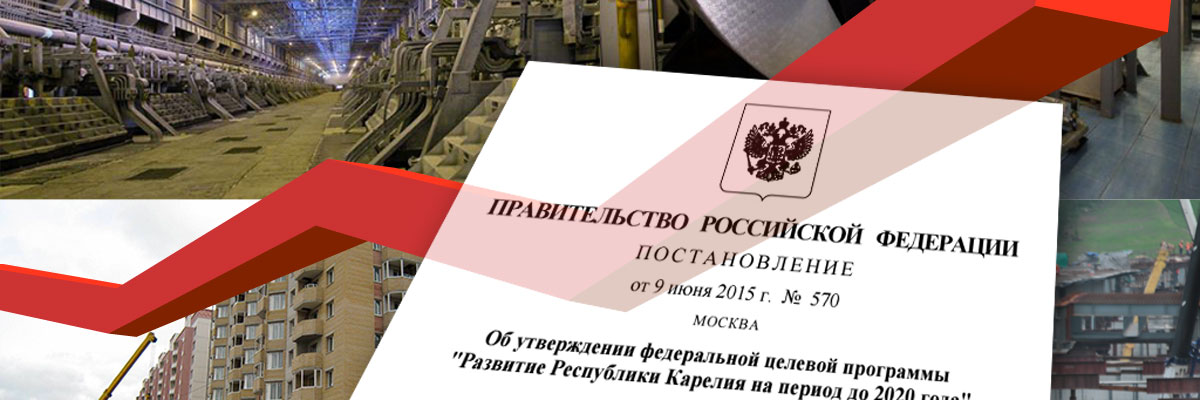
More than 270 thousand square meters of housing were built in Karelia in 2015. Of these, 84.2 thousand are in Petrozavodsk. This is a record figure in the region over the past 24 years.
According to the regional program for the resettlement of emergency housing, 7,015 people will receive new apartments by 2017. 591 emergency houses will be resettled.
111 emergency houses have already been resettled. More than 1.2 thousand people moved to new housing.

Road repair
For the first time in the history of the republic, the federal budget was allocated for road repairs. It was decided to spend 450 million on road network Petrozavodsk.
This is 101 streets or 476 thousand square meters of road surface.
Three republican highways are being put in order with the remaining funds. One of the most dangerous roads in Karelia, the Petrozavodsk-Suoyarvi highway, will also be repaired.
The amount of funds allocated for road repairs from the regional budget has doubled compared to 2015.

Social sphere
In the first six months of 2016, more than 70 percent—11.4 billion rubles—was allocated to education, healthcare, culture and social security.
There are 25.9 thousand rubles per resident of the republic, which exceeds the average for Russia.
The number of new jobs in Petrozavodsk will reach one thousand by the end of the year.
Last year, 634 places appeared in kindergartens in the Karelian capital. In 2016-2017, another 704 places will be opened.

Local Initiatives Support Program
Since the start of the program in 2014.
Its popularity has increased so much that in 2017, funding for the program approximately increased by one and a half times - from 37 million to 50 million rubles.
Thanks to the program, the “Lesnoy Klyuch” (Repnikova Street) and “Green Coast” (Sofya Kovalevskaya Street) parks appeared in Petrozavodsk this year.

Improvement and housing and communal services
In 2016, 5,298,000 rubles were spent on the improvement of Petrozavodsk.
During the spring “Clean City” campaign, more than 260 cleanup days were held, involving about 15 thousand people. In particular, 15 mass events were held to plant greenery in the central streets of Petrozavodsk.
130 hectares of public areas have been put in order. 700 trees were planted in the city. By the end of the year, about 400 more seedlings will appear on the streets.
Now there are four more green areas in the capital of Karelia: a park on Bornavoloskaya Street; Alley of Russia; a square at the intersection of Alexander Nevsky Avenue and Kalinin Street; square on Lenin Avenue - from Gagarin to Engels.
The landscaping of the squares named after Maria Melentyeva and Anna Lisitsyna is underway; landscaping empty lawns on dividing strips along Lososinskoye Highway.
The courtyards of houses No. 6 and No. 6-b on Zheleznodorozhnaya Street and No. 7 on Melentyeva are being landscaped. There will also be sports grounds there.
Children's play complexes are being installed at Onezhsky station, 10; Bornavolokskaya, 2; Gagarina, 2. At the intersection of Sortavalskaya and Pitkyarantskaya streets, a children's sports and play complex is being repaired.
Children's and sports grounds appeared at house No. 16 on Lev Tolstoy Street. Sports grounds will also be installed on Leningradskaya streets (between houses No. 8 and 10) and Sovetskaya (between houses No. 33 and 35).
Water supply and sewerage were installed in house No. 8 on Pirogov Street. There is an illuminated pedestrian crossing on Green Street.

Industry
The volume of mineral extraction in the six months of 2016 increased by 3.1 percent and exceeded the same indicators of last year.
Compared to the same period in 2015, the production of non-metallic construction materials increased by 23.3 percent. This is 3.3 million cubic meters.
Raw wood production has increased by 15 percent over the past three years; by 14 percent - longitudinally sawn timber.
From January to May of this year, it was possible to achieve an increase in the production of pulp and paper products by 15 percent. The growth in volumes of processed wood and production of wood products in the first five months of 2016 amounted to 111.3 percent. In pulp and paper production - 115.2 percent.
In general, the index of industrial production in Karelia was: in 2015 - 99.2 percent. For comparison, the Russian figure is 2.6 percent lower. Based on the results of the first six months of this year, these figures are as follows: in Karelia - 105.6 percent; the average for Russia is 100.1 percent.
Tax payments from the mining complex increased by 14 percent. Twice - from fishing enterprises. 33 percent - from hotels and restaurants.

Budget revenues
In January-June 2016, the republican treasury was replenished by 9 billion 178.2 million rubles. This is 518.4 million rubles more than last year.
Tax revenues on corporate profits increased by 22 percent and amounted to 2.1 billion rubles.
In 2016, 8.3 billion rubles were allocated to local budgets.
U participation in federal programs
Karelia participated in 25 federal target and state programs, in 14 programs with federal investments.
11 investment projects have been completed with a total investment of more than 2.3 billion rubles.
By the beginning of 2016, 130 investment projects were in various stages of readiness in our republic.

Tourism
In 2013, the number of tourists in the republic for the first time reached the pre-crisis level of 2008. Since then, the number of tourist visits has increased year by year.
Thus, in our region the dynamics of the number of organized tourists and excursionists is monitored:
- 2014 - 655 thousand people;
- 2015 - 720 thousand tourists.
According to experts, in 2016 this figure will be 760 thousand people.
And here are the official statistics on visits from tourists who stay in the republic for at least one night:
- 2014 - 260.7 thousand people;
- 2015 - 270 thousand people.
In 2016, up to 285 thousand such tourists are expected in Karelia.
At the same time, the number of organized tourists and excursionists in 2015 amounted to 1,138 people per thousand local residents. In the North-West, in terms of this indicator, Karelia is still second only to St. Petersburg and the Leningrad region.
To use presentation previews, create a Google account and log in to it: https://accounts.google.com
Slide captions:
Republic of Karelia
Capital – Petrozavodsk State language – Russian Head of the Republic – Khudilainen Alexander Petrovich Anthem – Anthem of Karelia
The republic is located in Northern Europe, in the northwestern part of Russia, washed by the White Sea in the northeast. The highest point of the Republic of Karelia is Mount Nuorunen
The Republic of Karelia is located in a time zone designated by international standard as Moscow Time Zone.
The climate is mild with plenty of rainfall. Winter is snowy, cool, but usually without severe frosts. Summer is short and with high rainfall.
There are 175 deposits of 24 types of minerals in Karelia.
There are about 27,000 rivers in Karelia, of which the largest are: Volda, Kem, Onla, Unga, Chirka-Kem, Kovda, Shuya, Suna, Vyg. There are also about 60,000 lakes in the republic.
The fauna of Karelia is young, it was formed after the Ice Age. The territory of the republic is home to 63 species of mammals, many of which, for example, the Ladoga ringed seal, the flying squirrel and the brown long-eared bat, are listed in the Red Book.
Karelia is home to 285 species of birds, of which 36 species are included in the Red Book of Karelia. The most common birds are finches. Karelia is a land of berries; lingonberries, blueberries, cloudberries, blueberries, and cranberries grow here in abundance.
Most of the territory of Karelia is occupied by the state forest reserve.
Total: 634,400 people. Average age: 37.1 years Population
The Republic of Karelia is part of the Russian Federation.
Tourism objects: Martialnye Vody - the oldest resort in Russia. Kizhi Island - a world-famous monument of wooden architecture Ice Palace in the city of Kondopoga And others
Thank you for your attention
Preview:
Slide 1
Republic of Karelia
Slide 2
General information
Capital - Petrozavodsk Federal District - Northwestern Economic region - Northern State language - Russian Head of the Republic - Andrey Nelidov Anthem - Anthem of Karelia
Slide 3
Geography:
The main relief of the republic is a hilly plain, turning in the west into the West Karelian Upland. The glacier, retreating to the north, greatly changed the topography of Karelia - moraine ridges, eskers, kamas, and lake basins appeared in abundance. The republic is located in Northern Europe, in the northwestern part of Russia, washed by the White Sea in the northeast. The highest point of the Republic of Karelia is Mount Nuorunen
Slide 4
Time zone
The Republic of Karelia is located in a time zone designated by international standard as Moscow Time Zone (MSK/MSD
Slide 5
Climate
The climate is mild with plenty of precipitation, changing in Karelia from marine to continental. Winter is snowy, cool, but usually without severe frosts. Summer is short and cool (in the northern regions), with a lot of precipitation. Even in June there are sometimes frosts in the republic. Heat is rare and does not occur for two to three weeks in the southern regions every year.
Slide 6
Geology
There are 175 deposits of 24 types of minerals in Karelia. Mica, feldspar, quartz, facing stone, as well as a variety of building materials - granites, diabases, marbles - are actively mined. There are gold, silver, diamonds, rare earth metals. Deposits of iron ore, titanium, vanadium, and molybdenum are being developed. Deposits of uranium ores have been explored (primarily Onega).
Slide 7
Hydrology
There are about 27,000 rivers in Karelia, of which the largest are: Volda (length - 149 km), Kem (191 km), Onla (197 km), Unga, Chirka-Kem (221 km), Kovda, Shuya, Suna with a waterfall Nodding, Vyg. There are also about 60,000 lakes in the republic. Together with the swamps, they contain about 2000 km³ of high-quality fresh water. Ladoga and Onega are the largest lakes in Europe. Other large lakes of Karelia: Nyuk, Pyaozero, Segozero, Topozero, Vygozero, Yushkozero.
Slide 8
Flora and fauna
The fauna of Karelia is relatively young, it was formed after the Ice Age. In total, 63 species of mammals live on the territory of the republic, many of which, for example, the Ladoga ringed seal, the flying squirrel and the brown long-eared bat, are listed in the Red Book. On the rivers of Karelia you can see the lodges of European and Canadian beavers. The Canadian beaver, as well as the muskrat and American mink, are acclimatized representatives of the fauna of North America. The raccoon dog is also not an indigenous inhabitant of Karelia, it comes from the Far East. Since the late 1960s, wild boars began to appear, and roe deer entered the southern regions. There are bear, lynx, badger and wolf.
Slide 9
Karelia is home to 285 species of birds, of which 36 species are included in the Red Book of Karelia. The most common birds are finches. There are only 5 species of reptiles on the territory of the republic: common viper, spindle snake, viviparous lizard, sand lizard. Karelia is the land of berries; lingonberries, blueberries, cloudberries, blueberries, cranberries grow here in abundance; raspberries have taken root well in the forests, having moved from village gardens. In the south of the republic, strawberries and currants grow abundantly.
Slide 10
Forest
Most of the territory of Karelia (148,000 km², or 85%) is occupied by a state forest reserve. The total stock of growing forest resources of all types and ages is 807 million m³. Mature and overmature forest reserves total up to 4118 million m³, of which 3752 million m³ are coniferous forests.
Slide 11
Population
Total: 634,402 people
Urban: 537,395 (75.0%) Rural: 178,886 (25.0%) Men: 331,505 (46.3%) Women: 384,776 (53.7%) Women per 1000 men: 1161 Average age: 37 ,1 years Urban: 35.9 years Rural: 40.6 years Male: 33.9 years Female: 39.9 years Number of families: 279,915 (out of 701,314 people) In the city: 208,041 (out of 525,964 people) rural: 71,874 (out of 175,350 people) Health Statistics (2005) Births: 6,952 (fertility rate 9.9‰) Deaths: 12,649 (death rate 18.1‰)
Slide 12
Form of government:
The Republic of Karelia is part of the Russian Federation with a republican form of government. The status is determined by the Constitution of the Russian Federation and the Constitution of the Republic of Karelia
Slide 13
Industry
Industrial sectors using local natural resources: forestry, wood processing, pulp and paper, ferrous metallurgy, building materials industry. Industries using imported raw materials: mechanical engineering, non-ferrous metallurgy
Slide 14
Tourism
Tourism sites: Marcial Waters - the oldest resort in Russia, opened in 1719 by order of Peter the Great Paanajärvi National Park Kizhi Island - a world-famous monument of wooden architecture Valaam Island with the Valaam Monastery Kivach Falls Ruskeala Marble Canyon Waterfalls on the Tohmajoki River Yukankoski Waterfall on the Kulismajoki River Kumio Waterfall (Kumo) -threshold) Skerries of the Northern Ladoga region Mount Vottovaara Ice Palace in the city of Kondopoga Palace of Arts in the city of Kondopoga Karelian Puppet Theater
Related articles
-
Test “Rus in the 9th – early 11th centuries”
Task 1. Arrange historical events in chronological order. Write down the numbers that indicate historical events in the correct sequence in the table. The Baptism of Rus' The Calling of the Varangians The Emergence of an Empire...
-
Golovko Alexander Valentinovich
Alexander Valentinovich Golovko Alexander Valentinovich Golovko Lua error in Module:Wikidata on line 170: attempt to index field "wikibase" (a nil value). Creed: Lua error in Module:Wikidata on line 170: attempt to...
-
Phrases from the joker Phrases from the dark knight
"The Dark Knight" is a science-fiction thriller filmed in 2008. The high-quality and dynamic film was complemented by an excellent cast. The film stars Heath Ledger, Christian Bale, Maggie Gyllenhaal, Aaron Eckhart, Michael Caine, Morgan Freeman and...
-
Biology - the science of life
Specifics of biological drawing for middle school students Biological drawing is one of the generally accepted tools for studying biological objects and structures. There are many good tutorials that address this issue....
-
Amino acids necessary for humans How to remember all the amino acids
1. Amino acids Scarlet Waltz. Flies (from the log) Copper of Farewells, Grass of the Final. Clay Gray, Anxiety, Ceremony, Silence. Slate Depths of Falling Leaves (Fall into) Giant Arcades. That is: Alanine, Valine, Leucine, Isoleucine, Methionine, Proline,...
-
Independent reproduction of Andrea Rossi's cold fusion reactor in Russia
Owners know firsthand how much it costs to provide a private home with electricity and heat. In this article I want to share the latest news about the development of a new type of heat generator. The likelihood of an energy revolution when...